Flood Risk Intelligence
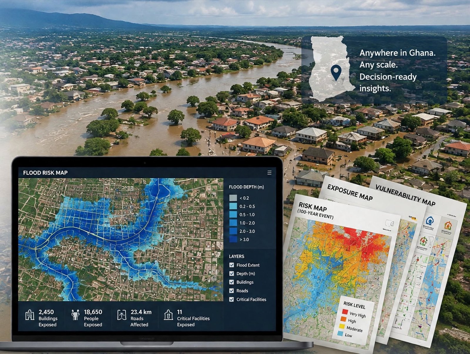
High-resolution flood risk screening at regional, MMDA, community and asset level for any location in Ghana, delivered remotely in days instead of months.
- Pluvial
- Fluvial
- Dam release
- Coastal
Hydro-informatics · Ghana · West Africa
Remote flood risk screening for any location in Ghana, backed by hydraulic modelling and a national hydro-database. Decision-ready reports in days, not months.
About the firm
MEK HydroInformatics is a specialist hydro-informatics services firm based in Ghana, with a footprint extending across the Anglophone West African sub-region. Owned by the MEK Group, the firm was founded in September 2025.
We leverage a national network of industry experts and in-house electronic data repositories to deliver bespoke consultancy, research and training solutions, for governmental institutions, international development agencies, private firms and investors in urban drainage and flood risk mitigation.

Five working clusters
Development of training modules and materials.
Computer model development and simulation.
Managing electronic data repositories and servers.
Data capture and processing, spatial analysis and map production.
AI workflow automation, dashboard and plugin development.
Services
High-resolution flood risk screening at regional, MMDA, community and asset level for any location in Ghana, delivered remotely in days instead of months.
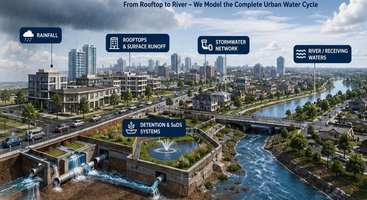
Specialist modelling capacity for engineering firms on a sub-consultancy basis: from rooftop to river, grounded in field data, GIS and hydraulic software.
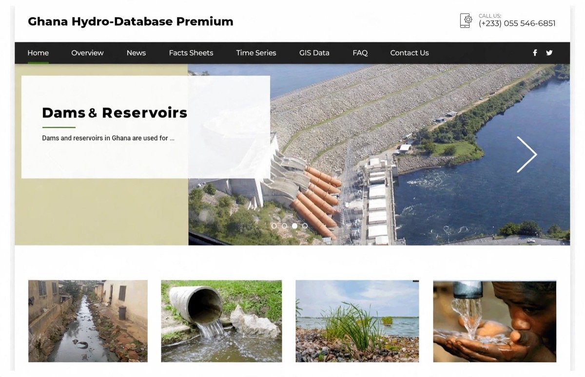
Analysis-ready drainage and flood datasets nationwide, plus the acquired Ghana Hydro-Database archive of historical hydro-meteorological records.
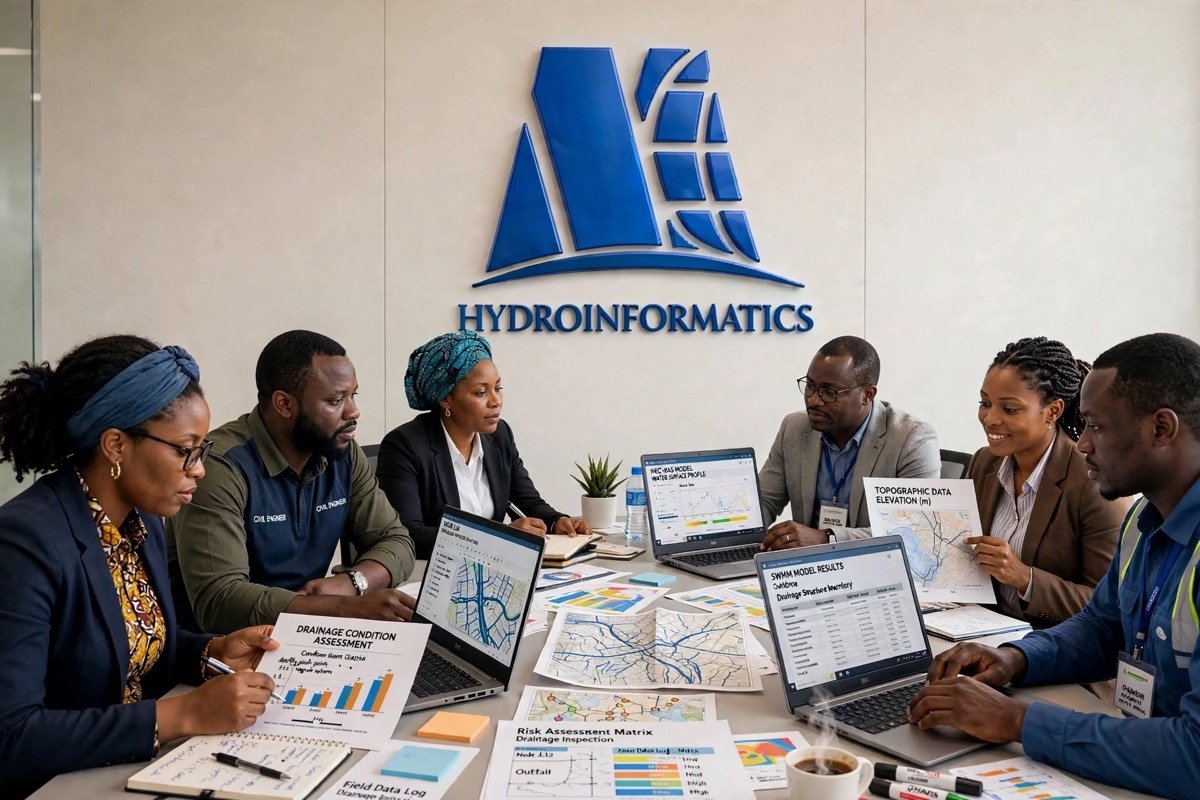
Skills needs assessment and customised software and thematic programmes for development agencies, professional bodies and public institutions in West Africa.
How it works
We screen your location remotely against hazard maps, hydraulic models and the hydro-database. You send a location; no site visit is needed.
On Premium assessments our team confirms conditions on the ground and checks the desktop findings.
You receive a written report, from a 2-page screening to a full assessment, with a risk rating for current and future climate.
Standard and Premium packages include a 30-minute or 1-hour session to walk through the results and recommendations.
Flood risk intelligence
Current and future climate scenarios across multiple return periods, mapped for populations, assets and critical infrastructure.
Return periods
Direct rainfall-induced surface water flooding and urban ponding.
Riverine flooding from overbank flows and catchment runoff.
Inundation from controlled releases and dam breach scenarios.
Storm surge, tidal flooding and shoreline retreat dynamics.
Flood Risk Intelligence Reports are delivered in days, not in months, so the answer arrives while the decision is still open.
Solutions
Every tier is a desktop assessment; Premium adds a site visit and future climate scenarios.
An independent, clear assessment of flood risk for any residential property, so you can buy with confidence and avoid costly surprises.
Ideal for: First-time buyers, homeowners and sellers, property investors, diaspora buyers, estate agents, lenders and legal professionals doing due diligence.
Desktop assessment
2-page screening report
Request Basic quoteDesktop assessment
10-page intelligence report
Request Standard quoteDesktop with site verification
15-page assessment report
Request Premium quoteA definitive view of flood exposure for any parcel in Ghana: is it in a flood zone, how likely is flooding, what would the impact be, and what can be done.
Ideal for: Land buyers, developers, investors and banks, estate agencies, site selectors and public sector institutions.
Desktop assessment
2-page screening report
Request Basic quoteDesktop assessment
10-page intelligence report
Request Standard quoteDesktop with site verification
20-page assessment report
Request Premium quoteOne portfolio, one view of risk. Consistent, actionable flood risk across anything from a handful of sites to hundreds of assets nationwide.
Ideal for: Real estate portfolios, retail and commercial chains, industry, logistics, infrastructure and utilities, health and education.
Desktop, up to 20 assets
10-page screening report
Request Basic quoteDesktop, up to 20 assets
25-page intelligence report
Request Standard quoteDesktop with site verification, up to 20 assets
40-page assessment report
Request Premium quoteH&H Data Store
Following our acquisition of the Ghana Hydro-Database repository, clients get unlimited access to historical hydro-meteorological time series, extreme flood events, layout maps, technical reports and literature dating back to the pre-colonial era.
Coastal rivers (Ayensu, Densu, Ochi Amissa, Ochi Nakwa, Tordzie, Aka) and south western rivers (Bia, Tano, Pra, Ankobra).
Drainage basin delineations and waterways for specific metropolitan, municipal and district assemblies.
Flowpaths of urban channels from source to outfall, with tributary confluences.
Inundation extents over buildings, roads, parcels and critical infrastructure.
Depth, velocity and arrival time, baseline and future climate, for the metropolitan areas.
Design peak discharges and runoff coefficients for sizing culverts, channels and bridges.
Delivered as
All datasets are QA/QC-checked and GIS-compatible, ready for engineering design, planning and risk assessment workflows.
Training
We partner with development agencies, professional bodies and public institutions to assess skills needs and deliver customised programmes.
Map urban flood hazards from hydrological data, GIS and vulnerability profiling, with West African case studies.
From field GPS surveys to a quality-controlled Drainage Network Information System.
Inspect and grade drainage assets, then prioritise maintenance and rehabilitation.
Georeferencing, drainage digitisation, DEM analysis and professional map production.
Rainfall-runoff modelling for urban catchments, including calibration where data is scarce.
River geometry, steady and unsteady flow, culverts and bridges, and 1D flood hazard maps.
Terrain processing, 2D meshes, coupled 1D/2D simulation and flood animations.
Sub-catchments, conduits and storage; surcharging, flooding and SuDS/LID options.
Downloads
River basins, MMDA watersheds, urban drainage channels and community flood exposure.
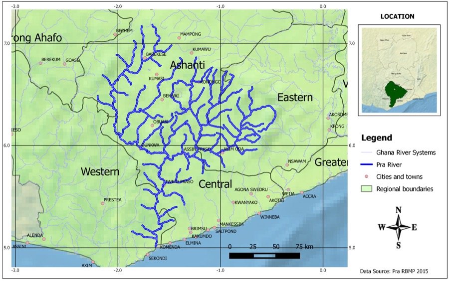 Pra
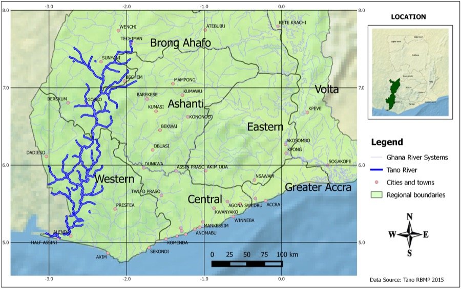 Tano
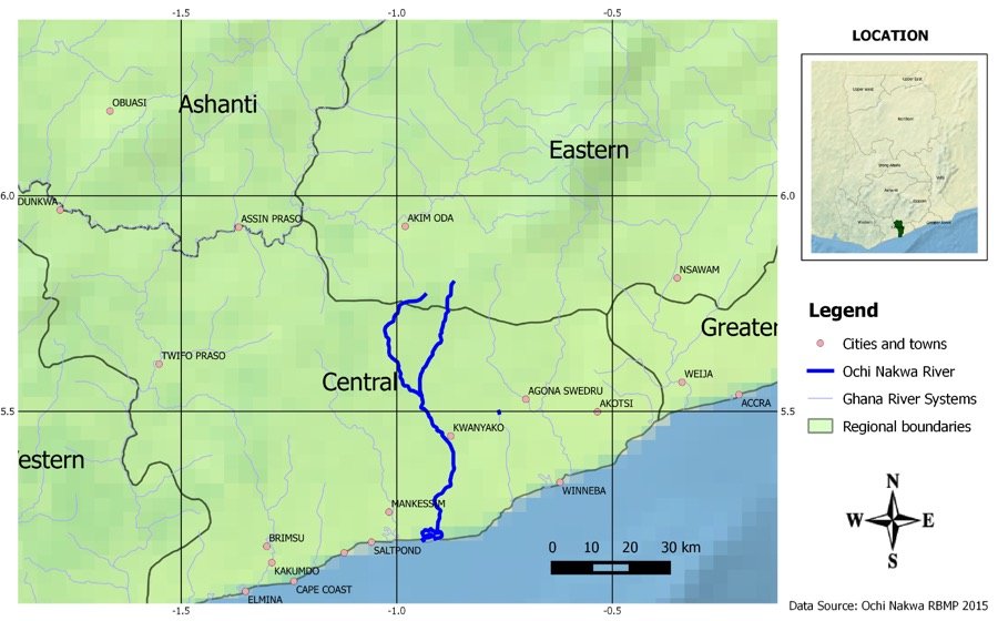 Ochi Nakwa
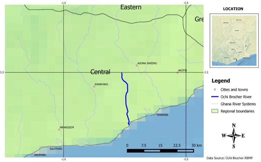 Ochi Brocher